
Yosemite's High Country, Fully Offline, in Your Pocket
A topographic map of Tuolumne Meadows to the summits, built from USGS 1-meter lidar terrain — with hikes, trail routing, placemarks, and GPS tracks that all work with no cell coverage.
Coming soon to the App Store for iPhone
Features

Fully Offline
The complete high country basemap is bundled with the app. No connection needed, ever, on the trail.

Lidar Terrain
Hillshade rendered from USGS 3DEP 1-meter lidar — terrain detail far beyond a scanned topo quad.

Hike Catalog
Curated hikes with measured distances, elevation gain, and elevation profiles.

Trail Routing
Point-to-point routes along the trail network, computed on-device from anywhere on the map.

Placemarks
Drop, name, and categorize your own map points — synced across your devices with iCloud.

GPS Tracks & GPX
Record and save your routes, export them as GPX, and import your own tracks and waypoints.
The Map Behind the App
A self-made basemap, built from authoritative public data.
Frequently Asked Questions
Yes — completely. The whole high country basemap ships inside the app, so the map, hike catalog, trail routing, placemarks, and GPS all work with airplane mode on and no cell coverage. Nothing needs to be downloaded before a trip.
Yosemite's high country — Tuolumne Meadows and the surrounding wilderness, out to the summits. The map is purpose-built for this area rather than a general-purpose map of everywhere.
$9.99 one-time purchase. No subscriptions, no ads, no in-app purchases. Pay once and own it forever.
Terrain comes from USGS 3DEP 1-meter lidar — the highest-resolution publicly available elevation data for the park. Trails and features come from OpenStreetMap, and lakes, rivers, and streams from the USGS National Hydrography Dataset. The basemap itself is rendered by the developer from these sources.
Yosemite High Country Map runs on iPhone and iPad with iOS 17.6 or later.
Yes. Everything you create is stored on your device; placemarks can optionally sync through your personal iCloud account, which no one else — including the developer — can access. There are no accounts, no ads, and no analytics. See the Privacy Policy for details.
The app is in beta testing now and coming soon to the App Store. This page will carry the download link the day it's live.
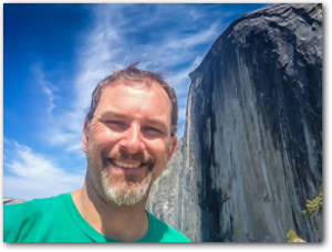
Built by Jorma.com — the same developer as Hawaii Ocean Map and halfdome.net — a Yosemite lover who also likes to build maps.
KNOW BEFORE YOU GO
This app is a planning and reference tool, not a substitute for backcountry preparedness. Trail conditions, water sources, and terrain change with season and weather; stats and routes are informational and may not reflect current conditions.
Carry a paper map and compass, check current NPS conditions and permit requirements, and make your own judgment in the field.